Using airborne laser-scanning for obtaining forest structural properties relevant to forest fires
Contact Persons
| Erich Meier | Felix Morsdorf |
Keywords
Airborne laser scanning, fuel-type mapping, canopy structure, single tree delineation, geometric reconstruction
Quick Reference
The European research project SPREAD investigates the main wildland fire domains fuel management, fire behavior, fire effects and fire management. The activities of RSL in SPREAD are described here
Timeframe
The project started in February 2002 and will run for three years. The data collection will took place in the Swiss National Park in August and October 2002 and consisted of two flights by DLR and Toposys, Germany and intensive field measurements for collecting ground truth data. The data collected during this field campaign will be completed through structural information of more than 2000 trees gathered by the Swiss Federal Institute for Forest, Snow and Landscape Research (WSL). A shaded threedimensional view of the Digital Surface Model (DSM) can be found below, with the area containing the field measurements of the WSL being enlarged. The photography was taken on the day of the LIDAR flight in October 2002 :

Results
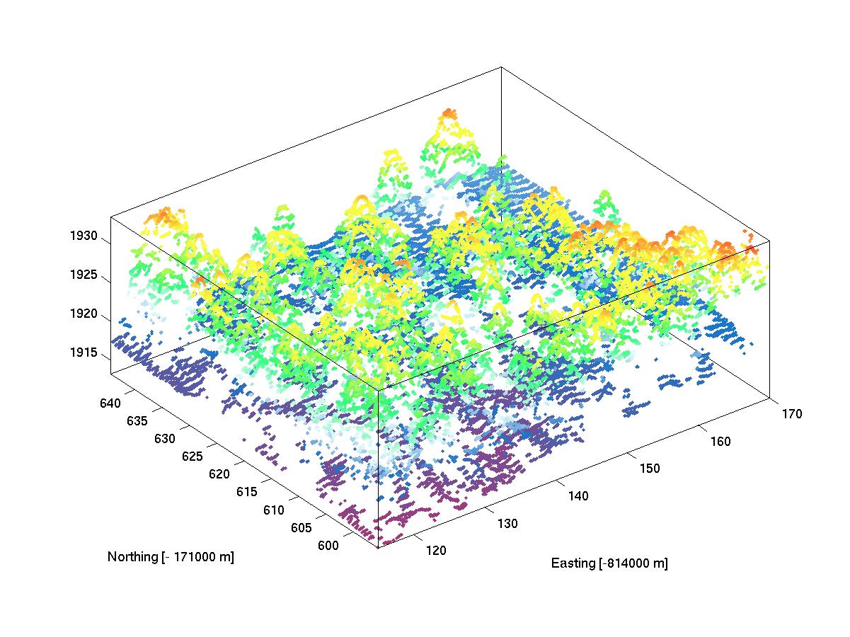
The main results will be algorithms in order to segment the LIDAR data into specified vegetation domains, and generate a representation of the 3-dimensional distribution. This structural information will then be combined with the fuel type aspects generated by the hyperspectral data. This data will then be used as input into forest fire models, which (up to now) work mostly with artifically constructed data. As a first approach, we have implemented a derivation of the geometric properties of single trees using cluster analysis. The raw data (as seen below) of the laser scanner provides high resolution information in form of x,y,z - triples. This data then has to be processed in order to generate digital terrain models (DTMs) and digital surface models (DSMs).
Methods
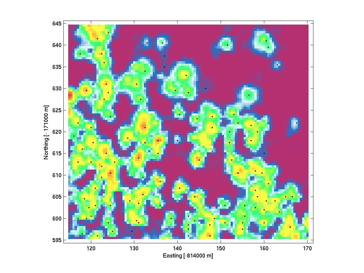
The LIDAR raw data (as seen above) is segmented using the location of tree tops as found by a local maxima filter in the DSM. In the image below a the DSM is shown with located tree positions indicated by black dots.
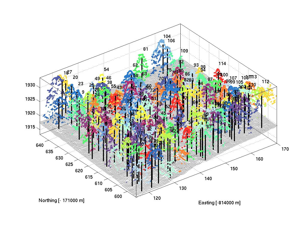
Off these positions, a kmeans clustering algorithm is used to segment the raw data in clusters of laser pulses belonging presumably to a single tree. The outcome of this algorithm is shown below. Different colors denote different cluster assignments.
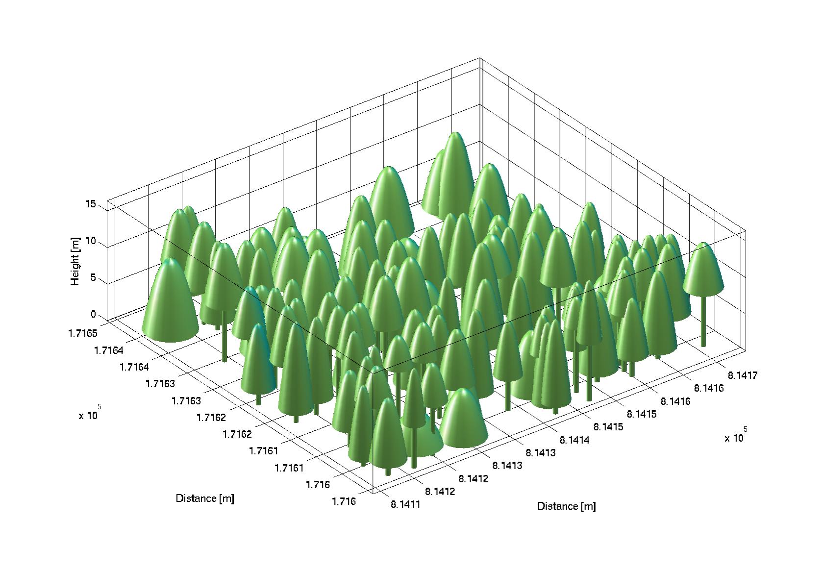
From the clusters, we can derive tree position, tree height, crown diameter and crown base height. With these values, a geometric reconstruction of the forest scene (as seen below) becomes possible. This information now can be used in fire propagagtion models and radiative transfer models.
Publications
List of LIDAR Publications