FireParadox - European Integrated Fire Management Project
Contact Persons
| Felix Morsdorf | Erich Meier |
Keywords
Airborne laser scanning, imaging spectroscopy, fuel-type/properties mapping, canopy structure, radiative transfer modelling
Abstract
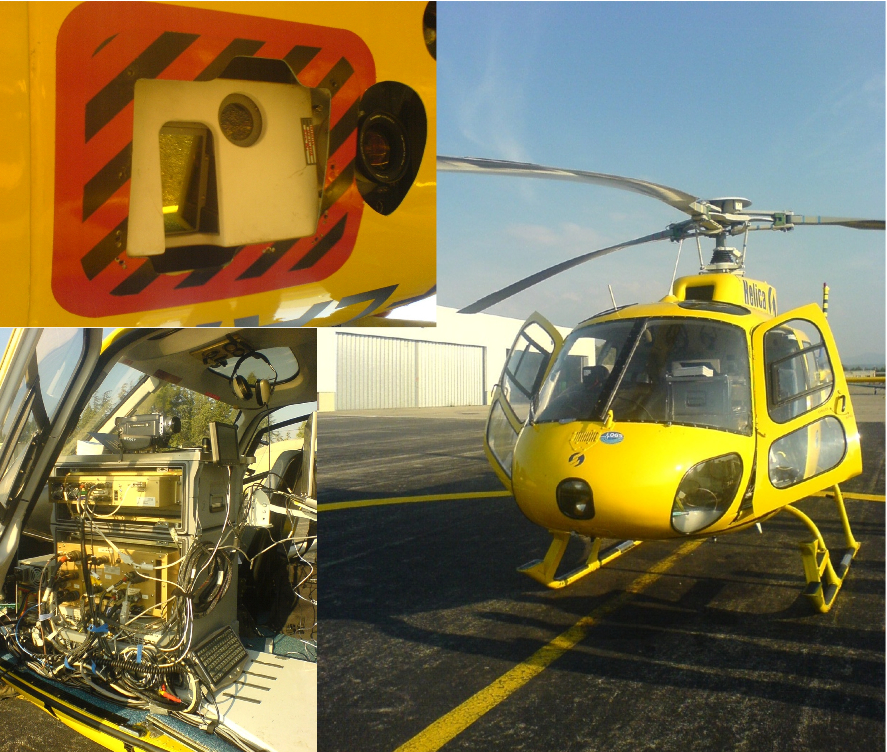
Wildfires are a major problem for many European societies threatening human lives and property with disastrous impacts particularly at the wildland-urban interface. On the other hand humans always used fire as a tool to regulate nature and traditional use of fire is known in many regions of Europe. The understanding of this paradox is thus essential for finding solutions for integrated wildland fire management. The European integrated project FIRE-PARADOX aims to provide an innovative approach of integrated wildland fire management. The FIRE-PARADOX project is comprising a team of 31 partner institutions spread over Europe with different expertise in the various aspects of wildland fire management. The contribution of the Remote SensingLaboratories at the University of Zürich will focus on fuel types and properties on landscape level with remote sensing. Airborne Imaging Spectrometry will deliver fuel type classification for different land-use classes (forest, shrub, agriculture, urban surfaces) delivering maps of the spatial distribution of fuel types. Airborne Laser-scanning will provide data for a detailed Digital Terrain Model (and thus Slope and Aspect), 3D fuel properties such as canopy height, canopy density and canopy cover, and vertical discrimination of fuel layers (e.g. crown base height). The spatial variability of the fuel properties as observed by remote sensing can be translated into fuel models important for the parameterization of forest fire behavior models. Earth observation by remote sensing offers thus the potential to provide spatially distributed information, such as fuel types, biomass, canopy structure, and fuel moisture, essential to assess fire risk and to mitigate the impact of wildland fires. In the summer of 2006 an airborne survey provided simultaneous observations of the two complementing sensors a small footprint LIDAR (Optech, ALTM3100) and an imaging spectrometer (AISA-Eagle) over a Mediterranean site close to Aix-en-Provence. The survey was conducted by the company HELICA-OGS on a Helicopter platform carrying both sensors.
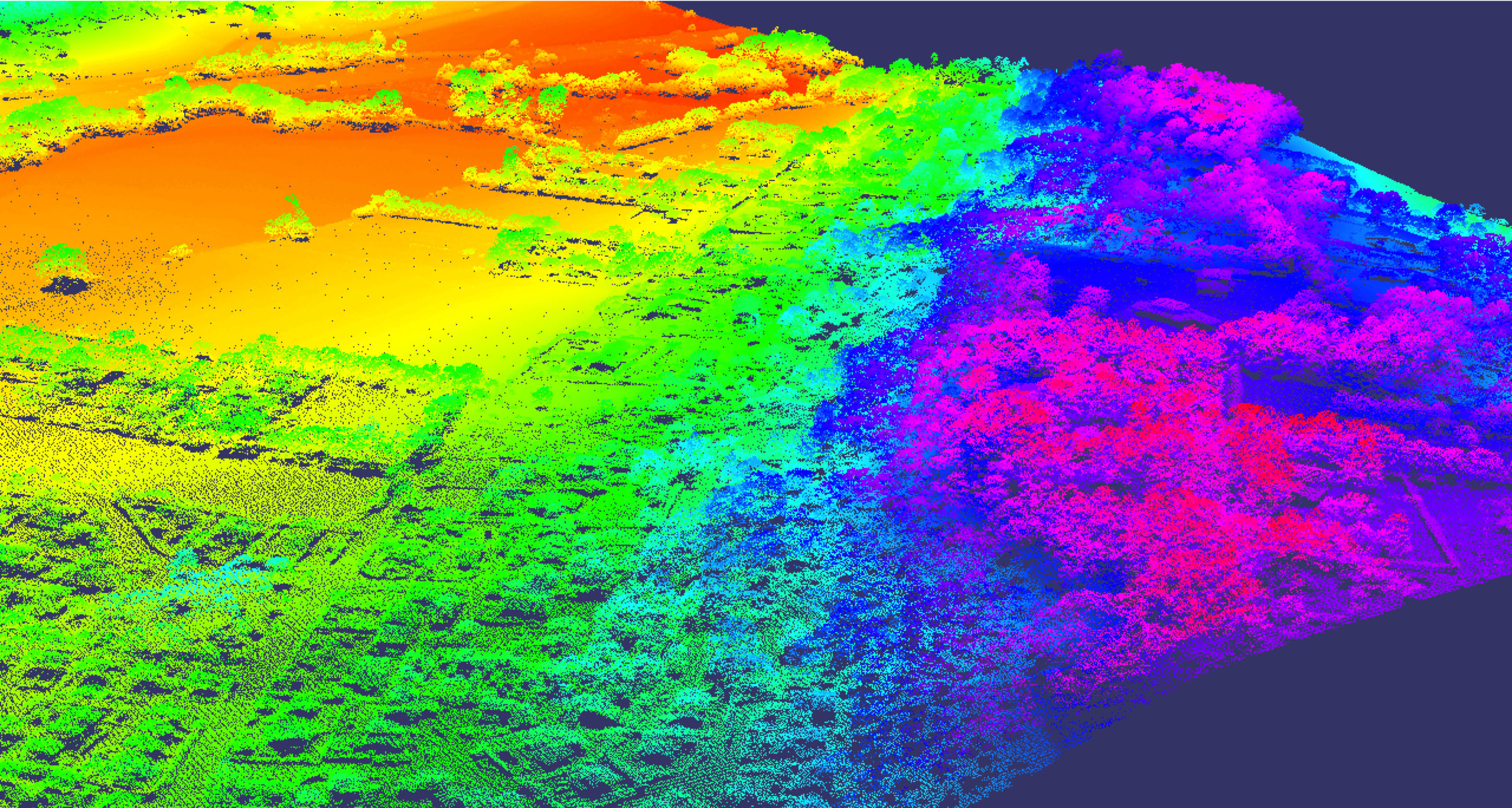
The LIDAR observations sample the spatial information dimension describing the geometric surface properties in high details.
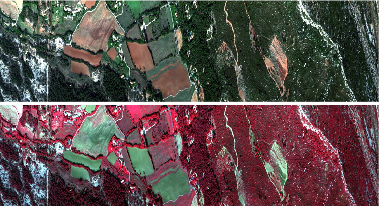
Imaging spectrometry on the other hand samples the spectral dimension, which is sensitive for discrimination of plant species and surface types.
Accurate fuel data represent a key element for reliable wildfire behaviour and propagation model-ling. Most fuel maps suggest homogeneous or uniform conditions within fuel classes (types), although greater variations can be found within vegetation types or plots than between. Examining fuel beds, a great variety in structure (vegetation height, bulk density, dead to live fuel ratios, etc.) and spatial distribution appears. The acquisition of precise fuel data in the field is costly, time and labour intensive and limited in its spatial extent. It is therefore an important task of this project to develop and test remote sensing methodologies that allow fast and reliable detection of high resolution fuel data for operational use in fire propagation modelling over large areas.
By combining these new airborne sensors, the University of Zürich will develop fuel detection methods that allow a 3D-representation of the whole fuel complex. For this purpose, static fuel properties (i.e., fuel type, geometry, location and structure of the different fuel bed strata / vegetation layers) as well as time dependent dynamic fuel properties (i.e., distribution of fuel moisture, proportion of dead-live material) will be characterised.
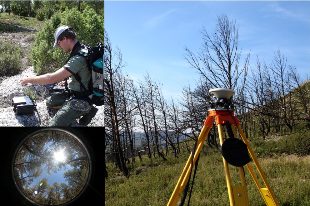
The test area for retrieving the remote sensing data is located in southern France, in the calcarous Provence. In these areas wildland fires manifest a serious threat in Summer. Testsites of two french institutions (INRA and Cemagref) are being used for validation of remote sensing based products.
Project Status
The project started in March 2006 and will run for four years. An extensive field campaign took place in the Provence in Summer/Fall 2006. Intensive field measurements provided the relevant reference data for calibrating and validating the acquired remote sensing data, and will enable the development of future methodologies.
Expected Results
The assimilation of spectral and geometrical remote sensing data (AISA and LIDAR) into retrieval algorithms present a very promising approach to allow a 3D-representation of the whole fuel complex. This new approach can be used to monitor the continuous spatial distribution of the forest canopy attributes at high spatial resolution providing quantitative information to support fire management decisions. We therefore propose to develop and test new methodologies based on remote sensing data to derive high resolution fuel bed properties such as fuel type, canopy structure and geometry, biomass, and fuel moisture.
Partnerships
FireParadox
HELICA-OGS
INRA Avignon
CEMAGREF Aix-en-Provence
Literature
List of LIDAR Publications
Remote Sensing Methodologies
Imaging Spectroscopy
Laserscanning (LIDAR)