GIS at AGILE 2025, Dresden, Germany - Best Poster Award
This year’s 28th AGILE conference (AGILE 2025) was held in Dresden, Germany, June 10-13, 2025, and focused on how Geographic Information Science (GIScience) is responding to Global Challenges.
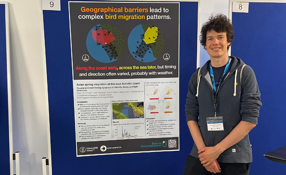.jpg)
Simon Hirschhofer (with co-authors Baptiste Schmid, Barbara Helm, Robert Weibel and Peter Ranacher) received the AGILE 2025 Best Poster Award, presenting work from Simon Hirschhofers's PhD research"Avian spring migration at the east Adriatic coast: coastal and sea-crossing dynamics of intensity, timing, and flight directions" Congratulations!
Yelu He (with co-authors Cheng Fu, Wernher Brucks and Robert Weibel) won third-place in the Best short paper competition for her paper "Modelling the influence of traffic infrastructure characteristics on e-scooter accidents in the city of Zurich" Congratulations!
Read the paper here https://doi.org/10.5194/agile-giss-6-26-2025
Zhiyong Zhou presented the paper "SpaGAN: A spatially-aware generative adversarial network for building generalization in image maps", co-authored by Cheng Fu and Robert Weibel.
Read the full article here https://doi.org/10.1016/j.jag.2024.104236
Alexandra-Ioana Georgescu presented the paper "Developing enriched pedestrian networks using accessibility features ", co-authored by Hoda Allahbakhshi and Robert Weibel.
Read the full paper here https://doi.org/10.5194/agile-giss-6-23-202
Zhiyong Zhou co-organized the pre-conference Workshop "2nd CartoAI Workshop 2025” with over 40 international participants presenting and discussing novel techniques of AI, machine learning and deep learning applied to maps or cartographic data (Program)

