Navigation auf uzh.ch
Navigation auf uzh.ch
To protect endangered migratory birds, we need to know their flight paths. But some birds are too small to carry a GPS tracker. By combining light, activity and wind measurements, their most likely route can be accurately estimated.
The protection of rare bird species in Switzerland does not end at their local habitats. Many are migratory birds and leave in autumn for their wintering grounds in Africa. They return to breeding grounds in Switzerland or elsewhere in Europe in spring. The more precisely their flight routes and stopovers are known, the better we can take targeted measures to protect these areas.
In a master's thesis in the GIS unit and in collaboration with the Swiss Ornithological Institute, a new statistical method was developed to reconstruct the migration routes of the hoopoe (upupa epops) more precisely. This bird has become rare in Switzerland and is too small to carry even the lightest GPS tracker on its long journey. Instead, so-called geolocators are used, sensors weighing just a few grams. These record the length of daylight – which changes with latitude – and the bird's activity. They also measure the air pressure, from which the flight altitude can be estimated. But the inaccuracy of the flight paths reconstructed in this way is still several hundred kilometers.
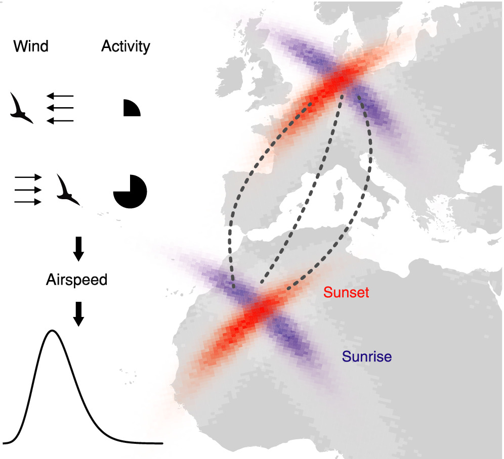
Mike Werfeli and Peter Ranacher have now integrated data on wind conditions at the bird's flight altitude into a statistical model to calculate the most likely route. If the birds encounter a tailwind, their speed relative to the ground increases significantly, so they are more likely to be able to travel longer distances. However, if there is a headwind, they are likely to travel less far. Together with flight activity records, the authors can thus rule out routes with unrealistically high flight speeds that would not match the hoopoe's physical capabilities and identify its most likely migration route.
"Our new method helps to locate habitats of birds during their migration and to identify frequently visited resting sites," says Mike Werfeli, lead author of the publication. "This provides the basis for targeted measures to protect these areas and the corresponding bird populations."
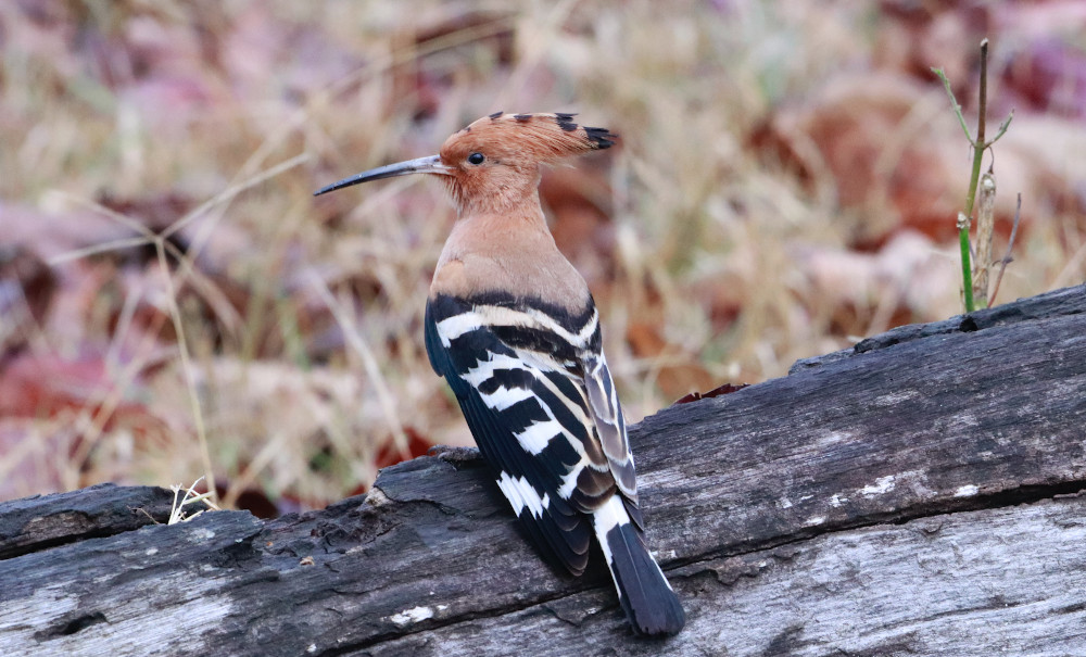
| The hoopoe (upupa epops) looks almost like an exotic bird with its opulent headdress, orange plumage and distinctive black and white bands. In recent decades, the intensification of agriculture has led to a drastic reduction in its food and nesting sites. In Switzerland, it is now only common in a few valleys in the cantons of Grisons, Ticino and Valais and western Switzerland. The hoopoe is one of the 50 priority species to be promoted with targeted projects and programs in Switzerland. Artenförderung Vögel Schweiz: Wiedehopf (in German only) |
Mike Werfeli, Peter Ranacher, Felix Liechti: Gone with the wind: Inferring bird migration with light-level geolocation, wind and activity measurements. Methods in Ecology and Evolution. 03 March 2022
Mike Werfeli (2020): Inferring migration routes of individual nocturnal bird migrants. MSc Thesis, Department of Geography
Communications