Events
Events Remote Sensing Spectroscopy
-
Keine aktuelle Veranstaltung
Für dieses Datum sind keine Veranstaltungen gemeldet.
The Remote Sensing Laboratories (RSL) offer many events.
If you have not been at RSL before, you should look up "how to find us" .
Remote Sensing Colloquium, Spring 2025
GEO 441.1: Colloquium in Remote Sensing
The colloquium in remote sensing focuses on a variety of remote sensing related topics, or - alternatively - on works showing potential to be used in collaboration with remote sensing based approaches. It serves the purpose of broadening the view on remote sensing related topics as well as fostering international contacts and cooperation.
The colloquium addresses students, staff and visitors interested in remote sensing and related topics. The format of the colloquium is a presentation (approx. 30 - 60 min.) followed by a discussion of approx. 5-15 min. The presentation and discussion language is English.
The colloquium forms part of the MSc curriculum and is embedded in the module GEO 441 (Specialization in Remote Sensing). It takes place in the spring semester (FS2025) and starts on February 18th on Tuesday at 14:00 (CET). Presentations will take place either on site (Y25-H79) or online. If presenters agree, on-site presentations may also be live-streamed. Presentations will not be recorded.
Participation is mandatory for RSL staff and registered students.
Spring Semester 2025
| Time & Place | Speaker | Title | Affiliation |
|
18. Feb. 25 2:00 pm. on-site |
student meeting | Students-only gathering to introduce to the Remote Sensing Colloquium. Participation mandatory for students only. | |
|
25. Feb. 25 2:00 pm. on-site |
Adrian Meyer | Fatal Accidents, Vital Predictions: Computer Vision for Wild Boar Distribution Modeling on the French Railway. | FHNW |
|
04. Mar. 25 2:00 pm. on-site |
Alexander Damm-Reiser | A remote sensing agenda for water systems research: From light measurements to tailored applications. | RSWS |
|
11. Mar. 25 2:00 pm. on-site |
Joan Sturm | How to work with swissEO – analysis-ready Sentinel-2 satellite data for Switzerland: GEE, python, and more. | swisstopo |
|
18. Mar. 25 2:00 pm. |
Meredith Schuman & Claudia Röösli | Genes from Space. | |
|
25. Mar. 25 2:00 pm. |
Aline Bornand | Deep learning for 3D point cloud completion. | SG/UZH |
|
01. Apr. 25 |
Tiit Kutser | Remote sensing of lake carbon dynamics. | University of Tartu |
|
08. Apr. 25 2:00 pm. on-site |
Florian Betz | Remotely sensed riverscapes: Towards a better understanding of the complex process regimes shaping riverine landscapes through earth observation. | Universität Würzburg |
|
15. Apr. 24 |
Jasmin Kesselring | Remote sensing of 3D forest gas exchange. | RSWS |
|
22. Apr. 25 |
Easter holidays | ||
|
29. Apr. 25 2:00 pm. |
Marco Weber | AI in Academic Research - Opportunities, Limitations and Threats. | UB/UZH |
|
06. May 25 2:00 pm. on-site |
Maria J Santos | Obsgession project | ESS |
|
13. May 25 2:00 pm. on-site |
Pauline Enguehard |
Amazon floodplains modelling under global warming and anthropogenic activities |
RSWS |
|
20. May 25 2:00 pm. on-site |
Holger Heisig | A Century of Historic Aerial Imagery of Switzerland: Georeferenced, Orthorectified, and Freely Accessible - A Vital Resource for Environmental Research and Integral Part of Switzerland's Landscape Memory. | swisstopo |
|
27. May 25 2:00 pm. on-site |
Gernot Paulus | TBC | SIENA |
Remote Sensing Colloquium, Spring 2024
GEO 441.1: Colloquium in Remote Sensing
Spring Semester 2024
| Time & Place | Speaker | Title | Affiliation |
|
20. Feb. 24 2:00 pm. on-site |
student meeting | Students-only gathering to introduce to the Remote Sensing Colloquium. Participation mandatory for students only. | |
|
27. Feb. 24 2:00 pm. on-site |
Nargiz Safaraliyeva | Remote Sensing of Multi-Year Plant Trait Change | UZH |
|
05. Mar. 24 2:00 pm. on-site |
Lukas Graf & Gregor Perich | EOdal - Earth Observation for Everyone | Terensis |
|
12. Mar. 24 2:00 pm. on-site |
Tiziana Koch | Satellite time series of tree species in Swiss forests | UZH |
|
19. Mar. 24 2:00 pm. remote |
Aga Bialek | Uncertainty evaluation for autonomous surface reflectance measurements. | NPL |
|
26. Mar. 24 2:00 pm. remote |
Benjamin Kellenberger | Species Distributions at Continental Scale – an Unexpected Journey of Challenges and Opportunities | Yale |
|
02. Apr. 24 |
Easter holidays | ||
|
09. Apr. 24 2:00 pm. on-site |
Jochem Braakhekke | Tracing the Cold | UZH |
|
16. Apr. 24 2:00 pm. on-site |
Anna Wendleder | Remote sensing of the cryosphere | DLR |
|
23. Apr. 24 2:00 pm. on-site |
Daniel Schläpfer | Hyperspectral Point Clouds: About the Processing of Imaging Spectroscopy Data in Four Dimensions. | ReSe |
|
30. Apr. 24 2:00 pm. remote |
Elnaz Neinavaz | Thermal Infrared Remote Sensing for Vegetation: From Computation of Land Surface Temperature to Retrieval of Vegetation Biochemical and Biophysical Variables. | Uni Twente |
|
07. May 24 2:00 pm. on-site |
Isabelle Helfenstein | Forest functional diversity assessment from space. | UZH |
|
14. May 24 2:00 pm. on-site |
Chris Baker | Radar for remote sensing | Uni Birmingham |
|
21. May 24 2:00 pm. on-site |
Teja Kattenborn | Tracking plant traits across spatial and temporal scales with machine learning | Uni Freiburg |
|
28. May 24 2:00 pm. on-site |
Clare Webster | Advances and challenges in using UAVs to measure forest snow energy balance processes | Uni Oslo |
|
04. Jun. 24 2:00 pm. on-site |
Peter Brotzer | A drone for high-resolution SAR images | UZH |
Remote Sensing Colloquium, Spring 2023
GEO 441.1: Colloquium in Remote Sensing
Spring Semester 2023
| Time & Place | Speaker | Title | Affiliation |
|
21. Feb. 23 2:00 pm. on-site |
student meeting | Students-only gathering to introduce to the Remote Sensing Colloquium. Participation mandatory for students only. | |
|
28. Feb. 23 2:00 pm. on-site |
Monika Kriemler | Workshop on Open Access and Scientific Publishing | UZH |
|
07. Mar. 23 2:00 pm. on-site |
Fabian Faßnacht | Applying synthetic remote sensing data to advance remote-sensing based biodiversity and forest monitoring | FU Berlin |
|
14. Mar. 23 2:00 pm. remote |
Andreas Reigber | Airborne SAR at DLR – Preparing futute satellite missions | DLR |
|
21. Mar. 23 2:00 pm. remote |
Sofia Ermida | Taking the temperature of the Earth through remote sensing | IPMA |
|
28. Mar. 23 2:00 pm. remote |
Hamed Gholizadeh | Using remotely sensed optical traits to map biological invasions in grassland ecosystems | OSU |
|
04. Apr. 23 2:00 pm. on-site |
Claudia Giardino | A journey through inland water remote sensing from the Nineties to the present. | CNR-IREA |
|
11. Apr. 23 |
Easter holidays | ||
|
18. Apr. 23 2:00 pm. remote |
Einar Bjorgo | From imagery to impact – the UNOSAT experience | UNOSAT |
|
25. Apr. 23 2:00 pm. on-site |
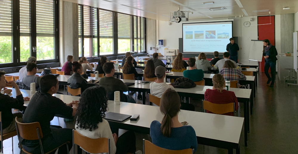
Helge Aasen | Earth Observation for Agroecology | Agroscope |
|
02. May. 23 2:00 pm. on-site |
Jennifer Adams & Kathrin Naegeli | Thermal remote sensing of complex ecosystems across spheres | RSWS & RS |
|
09. May. 23 2:00 pm. remote |
Sebastian Hafner | Multi-Modal Deep Learning with Sentinel-1 and Sentinel-2 Data for Urban Mapping and Change Detection | KTH |
|
16. May. 23 2:00 pm. on-site |
Petra D'Odorico | Watching them respond - How optical Remote Sensing can uncover tree responses to climate change | WSL |
|
23. May. 23 2:00 pm. on-site |
Marius Vögtli | Atmospheric, topographic, and anisotropy effects in airborne imaging spectroscopy data and derived products | RSL |
|
30. May. 23 2:00 pm. on-site |
Clare Webster | Advances and challenges in using UAVs to measure forest snow energy balance processes | UiO |
|
20. Jun. 23 2:00 pm. on-site |
Nima Pahlevan | Space-based studies of freshwater ecosystems: Towards synergistic use of multispectral and hyperspectral observations |
NASA |
| 11. Jul. 23 2:00 pm. remote | Melania Guerra, Rhodri Phillips | Planet Labs - Unlocking the power of high-cadence, high-resolution Earth observation data | Planet Labs |
Remote Sensing Colloquium, Spring 2022
GEO 441.1: Colloquium in Remote Sensing
Spring Semester 2022
| Time & Place | Speaker | Title | Affiliation |
|
22.Feb.22 2 pm on site |
student meeting | Students-only gathering to introduce to the Remote Sensing Colloquium. Participation mandatory. | |
|
01.Mar.22 2 pm online |
Hugo Figueroa | A drone-borne 3-band SAR system and its multiple applications: case studies in agriculture | FAPESP |
|
08.Mar.22 2 pm online |
Lola Fatoyinbo | From Treetops To Coastal Depths – Monitoring Blue Carbon Ecosystems In The 3rd And 4th Dimension | GSFC |
|
15.Mar.22 2 pm online |
Heather McNairn | Using Synthetic Aperture Radar (SAR) to map and monitor agricultural landscapes | ORDC |
|
22.Mar.22 2 pm on site |
Daniel Kükenbrink | Close-range remote sensing to support the Swiss National Forest Inventory? | WSL |
|
29.Mar.22 2 pm online |
Deep Inamdar | The Utility of Point Cloud and Rectangular Pixel Raster Data Representations in Preserving the Integrity of Hyperspectral Imaging Data | McGill |
|
05.Apr.22 2 pm online |
Yves Bühler | Snow depth mapping in high alpine terrain | WSL/SLF |
|
12.Apr.22 2 pm |
- | presentation by Fatima Karbou is postponed to May 10th | |
| 19.Apr.22 | Easter holidays | ||
|
26.Apr.22 2 pm on site |
Christian Frankenberg | A global view on the carbon cycle from the vantage point in space | Caltech |
|
03.May.22 2 pm on site |
Andrea Manconi | Monitoring slope deformation with DInSAR | WSL/SLF |
|
10.May.22 2 pm on site |
Fatima Karbou | Monitoring mountain snowmelt lines using segmentation techniques applied to Sentinel-1 SAR images | CNRM |
|
17.May.22 2 pm on site |
Lukas Emmenegger | Quantum cascade laser spectroscopy for environmental gas sensing | EMPA |
|
24.May.22 5 pm online |
Troy Magney | Scaling plant physiology from the leaf to the landscape | UC Davis |
|
31.May.22 2 pm online |
Stefan Simis | Global Remote Sensing of Lake Water Quality – State of the art, Challenges and new Opportunities | PML |
Remote Sensing Colloquium, Spring 2021
GEO 441.1: Colloquium in Remote Sensing
Spring Semester 2021
| Date/time | Speaker | Title | Affiliation |
| 23.Feb.21 2 pm | student meeting | Students-only gathering to introduce to the Remote Sensing Colloquium. Participation mandatory. | |
| 02.Mar.21 2 pm | Gerrit Kuhlmann | The Copernicus CO₂ Monitoring (CO2M) mission - Space Component of the European CO₂ Emission Monitoring and Verification Support System | EMPA |
| 09.Mar.21 2 pm | Miina Rautiainen | From needles to landscapes: understanding forest spectra at different scales | Aalto University |
| 16.Mar.21 2 pm | Dudu Meireles | Seeing leaf spectra in light of evolution | University of Maine |
| 23.Mar.21 2 pm | Joanne Nightingale | Satellite validation with a Metrology perspective: Fiducial Reference Measurements (FRM) for vegetation | NPL |
| 30.Mar.21 2 pm | Anna Schweiger | Dimensions of biodiversity - A spectroscopic view | UZH |
| 06.Apr.21 | Easter holidays - no colloquium | ||
| 13.Apr.21 2 pm | Simon Trim | Spectral calibration, spectral response function shapes and related uncertainties | UZH |
| 20.Apr.21 2 pm | Zhaoju Zheng | Estimating functional traits at individual tree and pixel level by remote sensing | UZH |
| 27.Apr.21 2 pm | Fanny Petibon | Investigating species traits with leaf-based spectral measurements | UZH |
|
04.May.21 2 pm |
Vincent Humphrey | Remote sensing of droughts and their impact on terrestrial ecosystems | UZH |
| 11.May.21 5 pm | Laura Williams | Spectral detection of biodiversity effects on forest ecosystem function | UMN |
| 18.May.21 2 pm | Stephen Howell | Large-scale Arctic sea ice motion from Sentinel-1 and the RADARSAT Constellation Mission | Environment Canada |
| 25.May.21 5 pm | Bernd Scheuchl | Remote Sensing of Polar Regions | UCI |
| 01.Jun.21 5 pm | Franz Mayer | The Alaska Satellite Facility: Radar-based Earth Observation from the Center of Alaska | UAF |
Remote Sensing Colloquium, Spring 2020
GEO 441.1: Colloquium in Remote Sensing
Spring Semester 2020
| Date | Speaker | Title | Affiliation |
| 18.02.2020 | student meeting | Students-only gathering to introduce to the Remote Sensing Colloquium. Participation mandatory. | |
| 25.02.2020 | Richard Gloaguen | Operational multiscale imaging spectroscopy for mineral mapping | HZDR |
| 03.03.2020 | Daphne Stam | Polarimetry as a tool for characterising Solar System planets and exoplanets | TU Delft |
| 10.03.2020 | Tuuli Soomets | Retrieving phytoplankton primary production in lakes from remote sensing data. | ETIS |
| 17.03.2020 | Julian Fagir | Change Detection between High-Resolition Airborne SAR and RGB Data | RSL |
| 24.03.2020 | Gustau Camps-Valls | Cancelled | UV |
| 31.03.2020 | Julia Joswig | Global signals in plant traits | RSL |
| 07.04.2020 | Gustau Camps-Valls |
Advances in Machine Learning for Earth Observation |
UV |
| 14.04.2020 | Osterferien | - | |
| 21.04.2020 | Cristina Ananasso | Copernicus: Europe's eyes on Earth | EC |
| 28.04.2020 | Zoran Sjanic |
Cancelled |
LU |
| 05.05.2020 | Fatima Karbou |
Cancelled |
CNRM |
| 12.05.2020 | Lars Opgenoorth |
Cancelled |
UM |
| 19.05.2020 | Michael Berger |
Cancelled |
ESA |
| 26.05.2020 | Monica Garcia | Mapping vegetation function: Synergies between optical, thermal and photogrammetry information | DTU |
Remote Sensing Colloquium, Spring 2019
GEO 441.1: Colloquium in Remote Sensing
Spring Semester 2019
| Date | Speaker | Title | Affiliation |
|
19.02.2019 |
student meeting |
Students-only gathering to introduce to the Remote Sensing Colloquium. Participation mandatory. | |
| 26.02.2019 |
Keith Morrison |
Earth Observation Using Ground-Based and Near-Ground SAR Systems |
|
| 05.03.2019 |
Astrid Bracher |
A detailed view from space: towards a global assessment of phytoplankton diversity |
AWI |
| 12.03.2019 |
Valerie Pasquarella |
Mapping past, present and future forests: Towards a stakeholder-driven multi-scale regional Forest Observatory |
BU |
| 19.03.2019 |
- |
no colloquium |
|
| 26.03.2019 |
Gillian Milani |
Observing water flow alteration on alluvial vegetation |
RSL |
| 02.04.2019 |
Jean-Baptiste Feret |
Modeling leaf optical properties for the remotely sensed estimation of leaf traits and beyond |
TETIS |
| 09.04.2019 | Jeremie Mouginot | Monitoring rapidly changing ice-sheets | IGE |
| 16.04.2019 |
Duccio Rocchini |
Biodiversity from space: real power and minotaurs |
University of Trento |
| 23.04.2019 |
- |
no colloquium - Easter holiday week |
|
| 30.04.2019 | Christian Rossi | From local to regional: Functional diversity in differently managed alpine grasslands | CHNP |
| 07.05.2019 |
Maarten Eppinga |
Putting ecological models to the test: a snapshot approach |
ESS |
| 14.05.2019 |
Emiliano Casalini |
Imaging of Ground Moving Targets in Airborne SAR Data |
RSL |
| 21.05.2019 |
Vladimir Wingate |
Estimating aboveground woody biomass change in Kalahari woodland: combining field, radar, and optical data sets | RSL |
| 28.05.2019 |
Camilla Brekke |
Remote sensing of marine pollution by synthetic aperture radar |
UiT |
Remote Sensing Colloquium, Spring 2018
GEO 441.1: Colloquium in Remote Sensing
Spring Semester 2018
| Date | Speaker | Title | Affiliation |
|
20.02.2018 |
student meeting |
Students-only gathering to introduce to the Remote Sensing Colloquium. Participation mandatory. | |
| 27.02.2018 |
Meinrad Abegg |
The quest for truth - about sampling theory, forests and terrestrial laserscanning |
WSL |
| 06.03.2018 |
Jonas Böhler |
From Pictures to Land Cover Maps - Classification of Field Crops Based on UAV Data | RSL |
| 13.03.2018 |
Anna Hogg |
Earth observation of the cryosphere: Hot topics in glaciology | University of Leeds |
| 20.03.2018 |
Helene Oriot |
Airborne high-resolution SAR images and applications |
ONERA |
| 27.03.2018 | Chengxiu Li |
Combined effects of human activities and environmental variables on vegetation traits in the Qinghai-Tibetan Plateau |
|
| 03.04.2018 | - | no colloquium - Easter holiday week | |
| 10.04.2018 | Daniel Kükenbrink | Measuring the aura of a tree: The impact of an isolated tree on the surrounding surface irradiance field. | RSL |
| 17.04.2018 | Erfan Haghighi | Linking pore- and landscape-scale processes towards improved estimation of land-atmosphere exchanges near the Earth’s critical zone | EAWAG |
| 24.04.2018 | Christine Gommenginger | Microwave remote sensing of the ocean | |
| 01.05.2018 | - | no colloquium - national holiday | |
| 08.05.2018 |
Marion Pfeifer |
Mapping and predicting ecosystem functions and services under environmental changes | Newcastle University |
| 15.05.2018 | Kirsten Thonicke |
Ecological sorting, plant competition and trait diversity: understanding forest dynamics using a dynamic global vegetation model |
PIK |
| 22.05.2018 | Mirco Migliavacca | Combining flux measurements and earth observations to diagnose ecosystem functions and essential biodiversity variables | MPI |
| 29.05.2018 | Florence Tupin |
Processing and analysis of multi-temporal SAR series and applications to urban areas
|
LTCI |
RSL’s Master Students Concept Colloquium
Date: 27.10.2017
Time: 09:00-12:00
Location: Y21-F-65 Theatersaal
|
08:30-9.00 |
Manuel Luck - “Biomass Estimations in a Forest - Comparing UAVLS and TLS Point Clouds” |
| 09:00-9.30 | Ewa Czyz - “Detecting intra-specific genetic variation in the Laegern temperate forest using airborne imaging spectroscopy time series.” |
| 09:30-10.00 | Isabelle Helfenstein - “Quantifying functional diversity variations of physiological forest traits between different spatial scales and optical sensors.” |
| 10.00-10:30 | Coffee break |
| 10:30-11.00 | Joan Sturm - “Extraction of general flowering metrics in Malaysian Borneo using optical indices on satellite data.” |
| 11.00-11:30 | Tobias Klee - “Point to area extrapolation of phenocam data at biodiversity test sites.” |
|
11:30-12:00 |
Bernhard Sassik - “Quantifying Grassland Degradation in the Borena Zone (Ethiopia) between 1980’s and 2016 using the Google Earth Engine.” |
Remote Sensing Colloquium, Spring 2017
GEO 441.1: Colloquium in Remote Sensing
Spring Semester 2017
| Date | Speaker | Title | Affiliation |
|
21.02.2017 |
Stéphane Jacquemoud |
Optical remote sensing of multi-scale surface roughness: A theoretical and experimental approach |
IPGP |
| 28.02.2017 |
Jan Wegner |
Large-scale Geospatial Computer Vision: Cities, Point Clouds, Trees |
ETHZ |
| 07.03.2017 |
|
no colloquium |
|
| 14.03.2017 |
Jing Xie |
The influence of snow accumulation on alpine vegetation: A case study in the European Alps |
RSL |
| 21.03.2017 |
Silvia Garbari |
From observations to environmental physics: Radiance based retrieval of vegetation parameters using combined models and MCMC |
RSL |
| 28.03.2017 | Donato Amitrano |
New perspectives for multitemporal SAR data analysis: Representation, understanding, and products |
Uni Napoli |
| 04.04.2017 | Alexandra Messerli | Remote sensing of the Cryosphere with focus on velocity mapping | Norwegian Polar Institut |
| 11.04.2017 | Laura Duncanson |
How much carbon is stored in Earth's forests? What we know, what we don't, and what we will know soon. |
NASA’s Goddard Space Flight Center |
| 18.04.2017 | no colloquium | ||
| 25.04.2017 | Elias Mendez | Change detection with SAR data | RSL |
| 02.05.2017 | Daniela Braun | Remote sensing-based ecosystem service mapping: From instantaneous to continuous ecosystem monitoring | RSL |
| 09.05.2017 |
Ansgar Kahmen |
Plant and ecosystem responses to hydrological changes | Uni Basel |
| 16.05.2017 | Eija Honkavaara |
Close-range hyperspectral 3D UAV remote sensing: A photogrammetric approach |
Finnish Geospatial Research |
| 23.05.2017 | Sanne Diek |
Soil properties from the air: How to optimise airborne soil spectroscopy |
RSL |
| 30.05.2017 | Anny Cazenave |
Space observations for monitoring climate change: A focus on sea level rise
|
CNES |
EARSeL Workshop on Imaging Spectroscopy
The 10th EARSeL Workshop on Imaging Spectroscopy took place at UZH from 19-21 April 2017