Earth Data Science


Our research focuses on data-driven environmental monitoring in alpine and cryospheric regions. Using multimodal Earth observation data (e.g. satellite imagery, climate reanalysis and topographic information), we quantify the response of glaciers, snow and land surfaces to climate change. We develop reproducible workflows for mapping and analysing dynamic surface processes, such as glacier loss, snowline elevation and land-surface temperature trends, by combining large-scale time series with machine learning and deep learning methods using cloud computing.
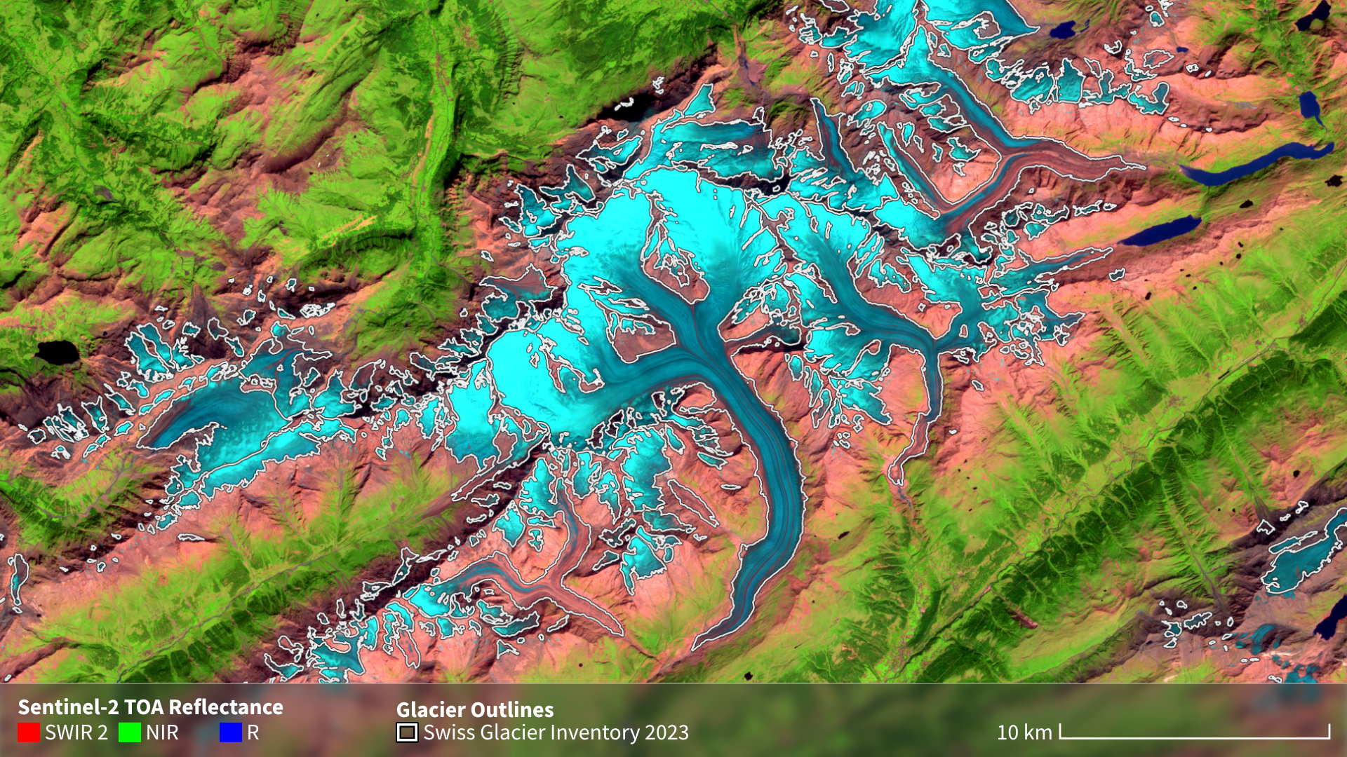
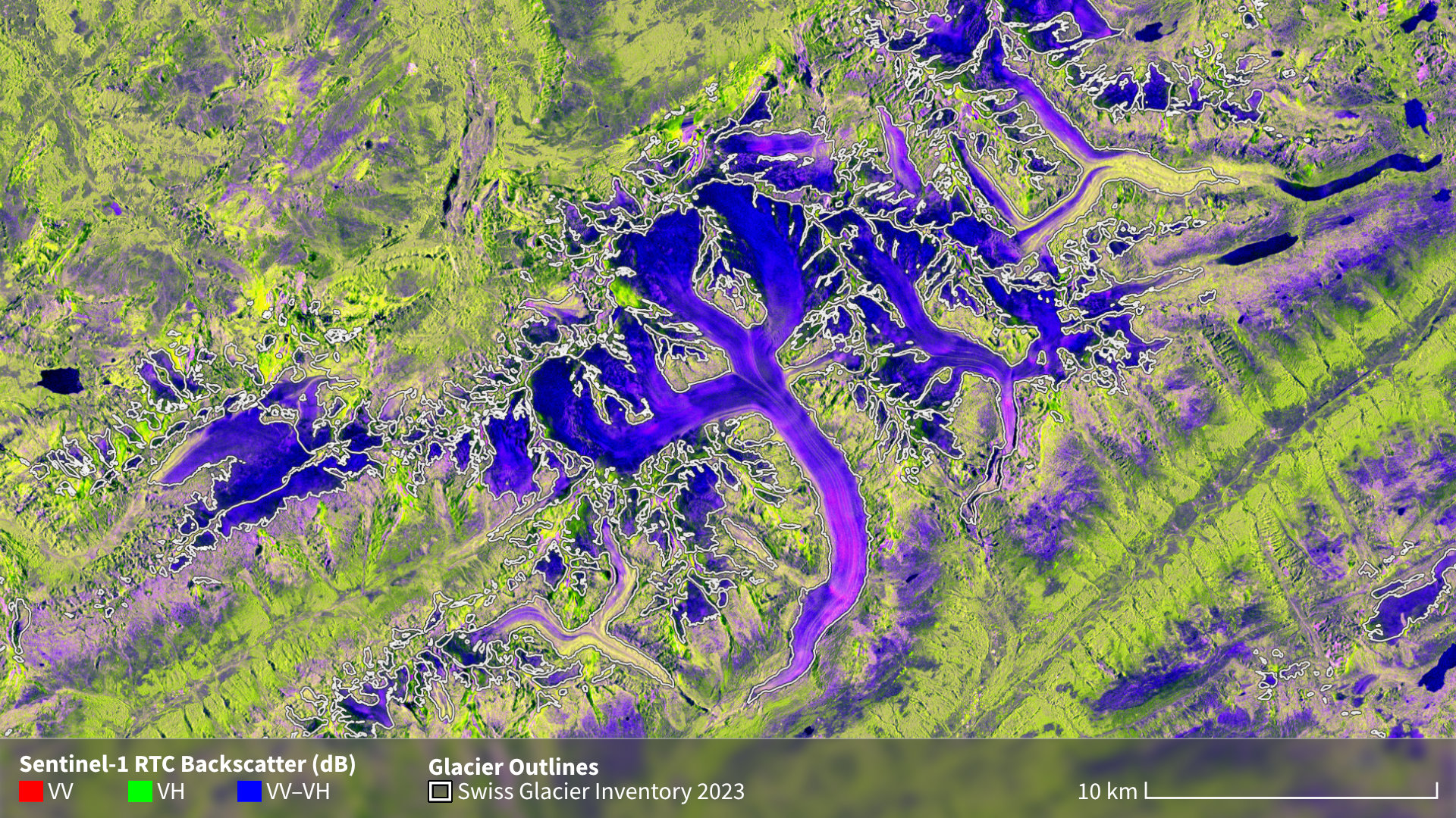
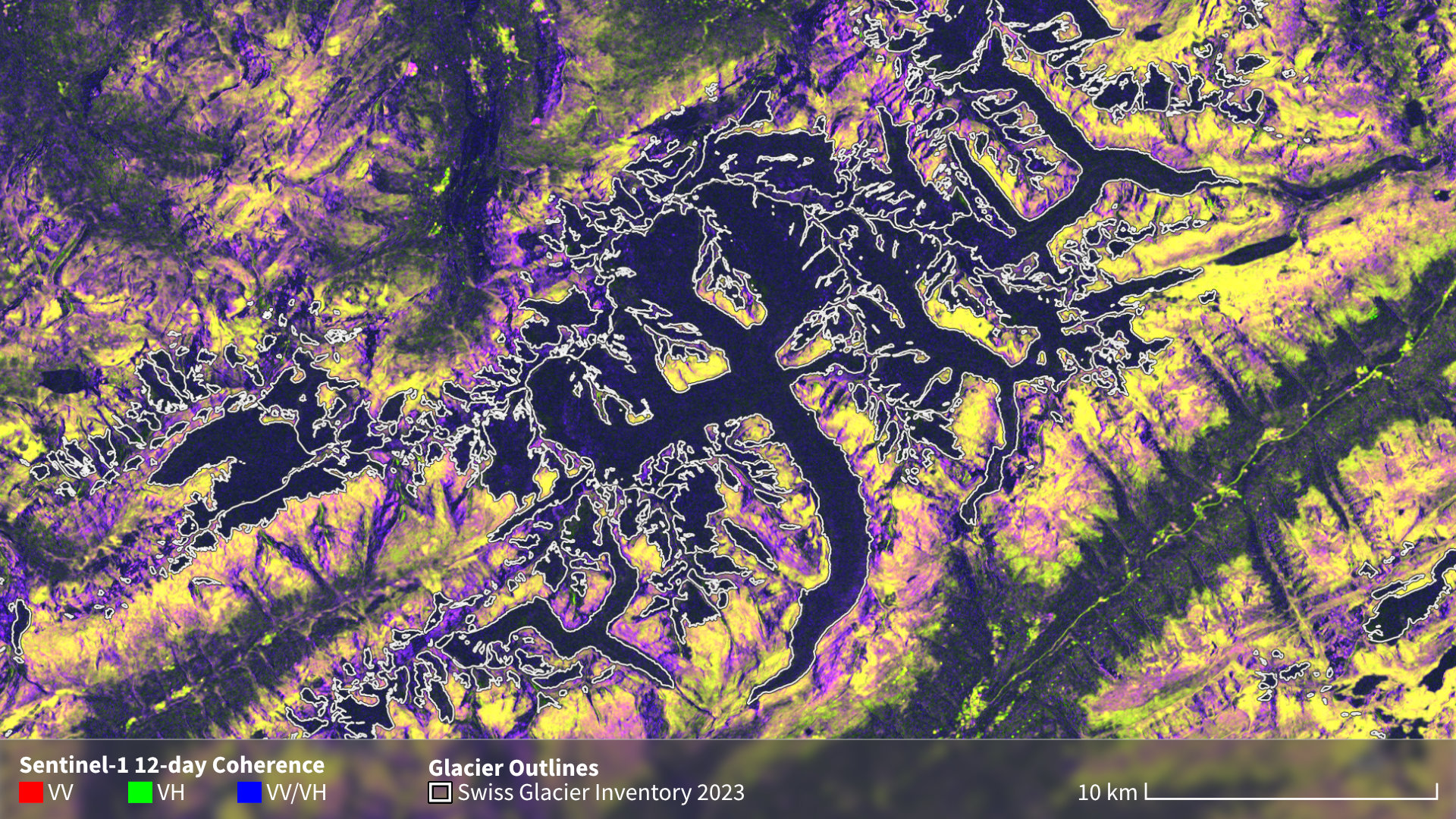
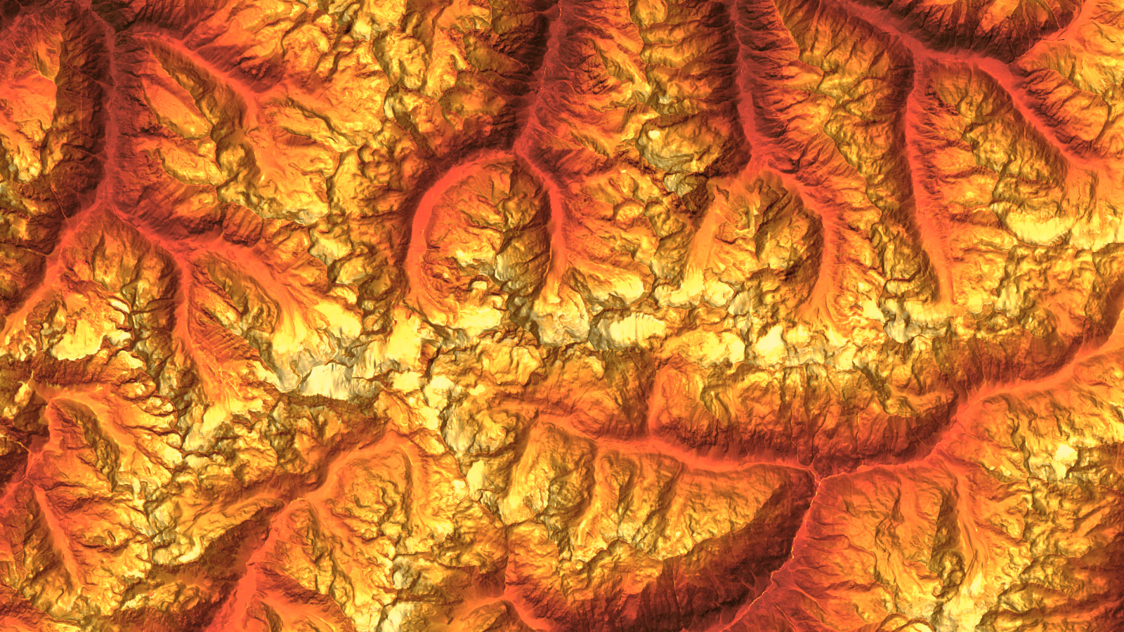
A central part of our current work, led by Luis Gentner, advances global glacier mapping using multimodal deep learning. His PhD project integrates optical, radar, and elevation data to automate glacier outline detection across diverse regions and glacier types. This project is an essential step toward consistent, global glacier inventories. Together, these efforts contribute to a better understanding of cryospheric change and its role in climate adaptation, natural hazards, and water resource management.