Wounded Rainforest
Alexander Damm-Reiser uses satellite data to analyze biodiversity, ecosystems and environmental damage and capture the results in images. Among other things, this makes it possible to assess the ecological footprint of companies objectively and independently.
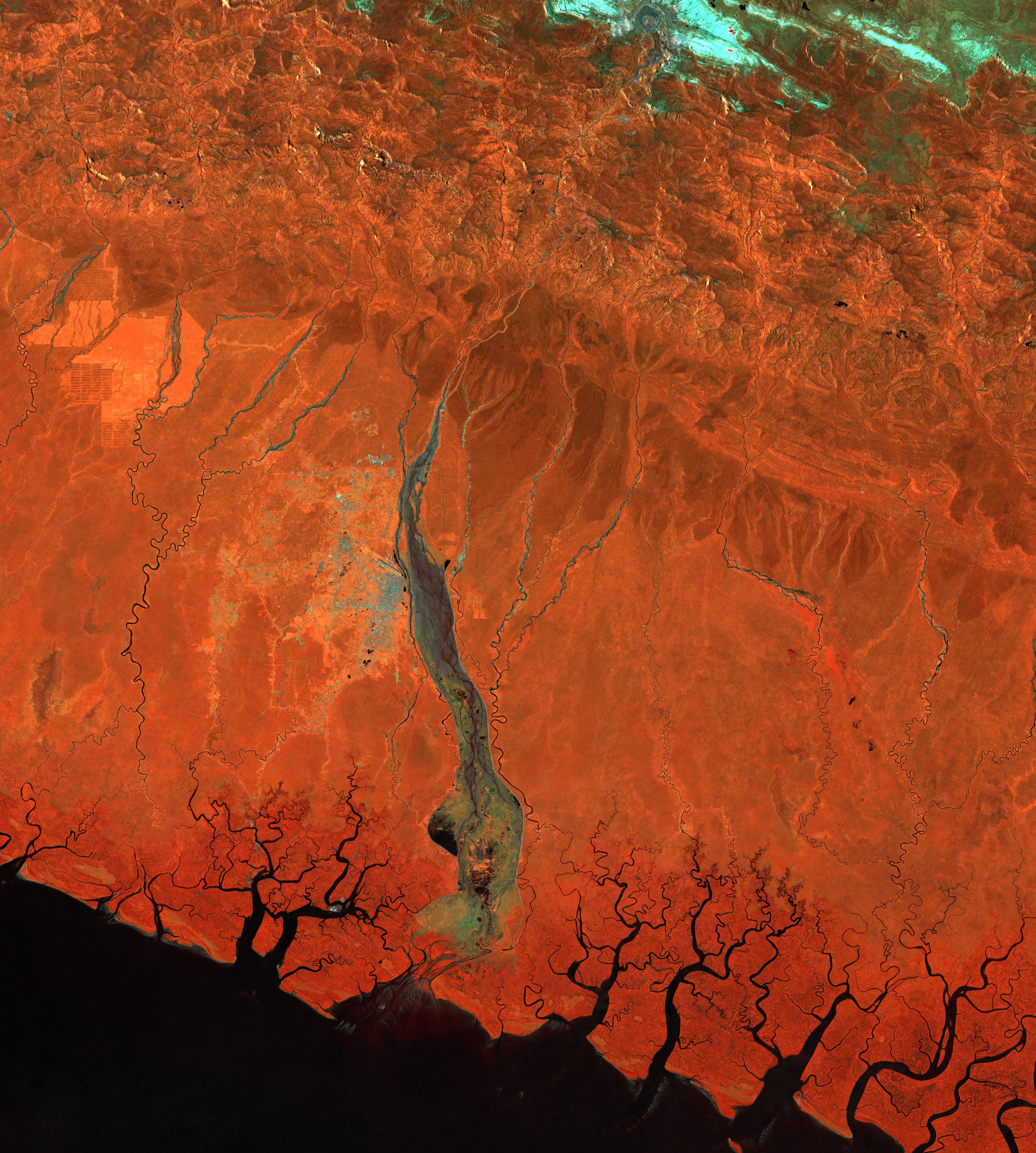
Up at the top of the mountain, there’s a huge wound: a crater that’s around two kilometers in diameter and several hundred meters deep. The Grasberg mine is one of the biggest and highest mines in the world. Gold, copper and silver are mined here, up in the remote mountains in the Indonesian province of Papua Tengah. Until 2019, this was done by open-cast mining, but since then the ores have been mined underground.
Papua Tengah on the island of New Guinea is one of the wettest regions in the world, with tropical rainforest covering the slopes all the way down to the Arafura Sea located some 100 kilometers away to the west of the Pacific Ocean. The crater of the mine is clearly visible on satellite images. The area to the south of the mine on the slopes of the Maoke mountain range glistens in varying shades of orange. The image is what is known as a false-color image. It depicts the near infrared spectral range, which our eyes can’t perceive, as Alexander Damm-Reiser, professor of remote sensing of water systems, explains.
Read the full article on UZH News
A satellite image in the near infrared range shows the Grasberg mine in Papua New Guinea. The crater of the mine is clearly visible in the center of the image. (Image: Modified Copernicus-Sentinel-2-Daten/Cloud Score+ /Google Earth Engine)